
Palisades parts 1&2
The last drives of 2023.
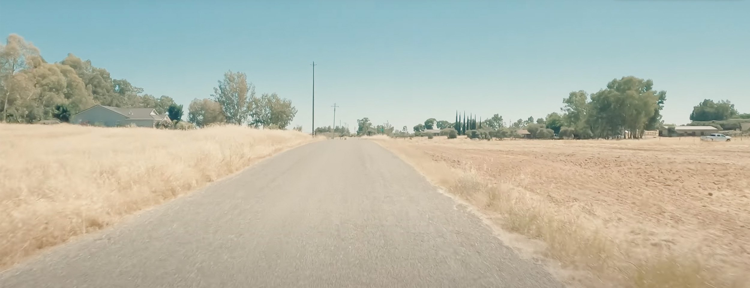
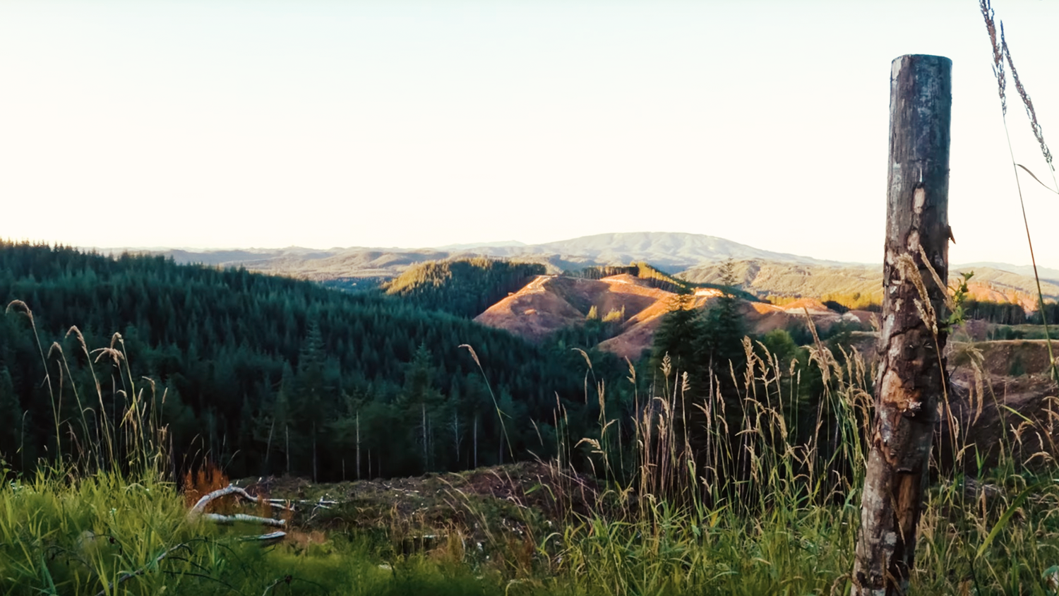
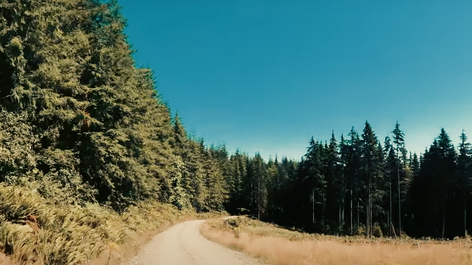
It’s September 17th, 2023, mid-morning and I’m heading east and up from Wenatchee into the Badger Mountains and a little beyond, it is what I believe, based on my map research, is called Palisades. It’s a nice mix of pavement, gravel, and wide-open scenery. Starting with nice climb up into the mountains before dropping back down onto the Columbia Plateau. The driving is a mix of curves, rolling hills and long wide-open straights. The gravel sections are easy to drive with good site lines and impressive views.
Palisades Road is a mostly long straight road with some slight direction changes back and forth. It’s pretty smooth, with a few gradual dips and rises. It feels very remote and encourages some assertive pressure on the right pedal. Martin Road NW is a relatively flat well-maintained road that contains a series of mostly slight s- turns with short straights. You’ll be surrounded on either side by orchards, canals, and other agriculture. You might glimpse the foothills off to your right. However, the road will keep your attention focused especially with how some of the s-curves link up. It also has the advantage that its sight lines are pretty clear through those turns, letting you straighten them out without the fear of being blind to oncoming traffic. Martin RD NW was a pretty great bookend on the driving day. Highly recommend!
Black Diamond goodness
Back at the end of August and the start of September of 2023, I did quick trips out to one of the finest but too-short roads for spirited driving close to home. I convinced my son to drive out there with me the following week. Great day, and a great drive!
A great mix of curves, elevation changes, and scenery.
July 15-22 2023 - California Snippets
July 15 - 2023 - Part 1
On a (very!) hot day in July outside Corning, I take a little tour of some typical NorCal backroads to some friends who live in Capay.
July 20th-ish? - 2023 - Part 2
It’s a little later in the week and yet another very hot and sunny July day out in Fremont California. I'm heading from the Bay Area to Sacramento to visit some more friends. Niles Canyon RD is a two-lane road with sweeping turns, a bridge or two, and a few long straights. It starts out next to a shallow creek with a slight curving uphill grade.

4th of July, 2023 - Drive to Whidbey Island Snippets
July 4, 2023 Pioneer Highway, Stanwood WA
On a gorgeous 4th of July morning, I head up to Whidbey Island for a family day. And as I like to do, instead of taking the Mukilteo Ferry, I’m taking the long way ‘round: driving a small back route. There’s also a nice hight-light of a small part of Pioneer HWY.
Mapping Software used:
Inroute
GaiGps
Google Maps
GPX: https://drive.google.com/file/d/1LS7I...
Music (via Epidemic Sound)
Vinyl effects: Justin Kain

SE Lake Dorothy RD - Mini-Drive
May 29, 2023 MIDDLE FORK SNOQUALMIE TRAILHEAD, WA
I head out early Memorial Day morning and do a “quick” drive up I-90 E to the Middle Fork Snoqualmie River Valley and SE Lake Dorothy RD.
The drive has gentle curves, long straights, and some interesting elevation changes. You’ll be surrounded by trees, water, and mountains. It turns out it’s not a driving road, but if you want a great spot to hike and camp, this is the right place.
Mapping Software
Inroute
GaiGps
Google Maps
Music (via Epidemic Sound)
* Before the Storm - Lucention: https://www.epidemicsound.com/track/B...
* Light Trails - Ooyy: https://www.epidemicsound.com/track/I...
* Black Tern - By Lotus: https://www.epidemicsound.com/track/c...
* Drifted - Ran the Man: https://www.epidemicsound.com/track/n...
* Fields, Particles - Ave Air: https://www.epidemicsound.com/track/m...
* Awoken - Purple Dive: https://www.epidemicsound.com/track/g...
*Almost Through - Baron Grand: https://www.epidemicsound.com/track/m...
Vinyl effects: Justin Kain
Thanks for watching!
-s

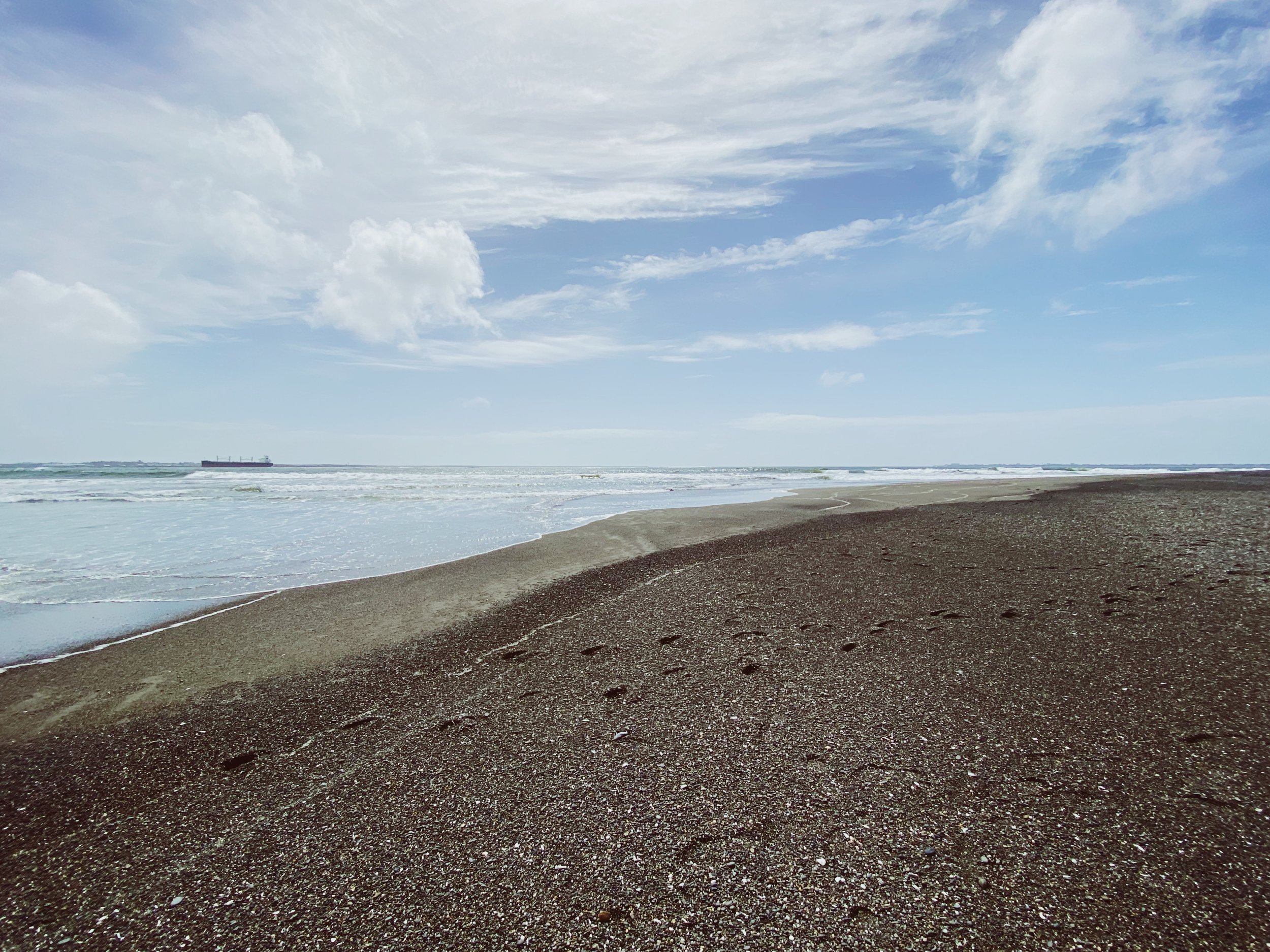
Damon Point Part 3
Wynooche - Wishkah - Hoquiam Roads
May 30, 2023 HOQUIAM, WA
Here we are part 3! The best for last, and the longest!
The first part and last part of this area turned out to be an unexpected treat. When I first arrived, I was a little worried about the traffic I was seeing but luckily it was all heading south. The sequence of Wynooche Valley, Wynooche Wishkah, Wiskah, Hoquiam Wishka and E Hoquiam, was filled with curves, straights and elevation changes. Some more enjoyable than others, but a solid grouping as a whole
Mapping Software
Inroute
GaiGps
Google Maps
Music (via Epidemic Sound)
* Abyssal Hibernation (Delta Drone L144Hz R147Hz) - Ookean : https://www.epidemicsound.com/track/v...
* Betawaves for Concentration (Short Version) - Joseph Beg: https://www.epidemicsound.com/track/A...
* Dna - Marten Moses: https://www.epidemicsound.com/track/K...
* Lost Hat - Dylan Sitts: https://www.epidemicsound.com/track/u...
* miles away - dreem: https://www.epidemicsound.com/track/J...
* Night Bells - By Lotus: https://www.epidemicsound.com/track/F...
* Peacemaker - Splasher!: https://www.epidemicsound.com/track/v...
* twisted stars - dreem: https://www.epidemicsound.com/track/f...
Vinyl effects: Justin Kain
Bonus Images
The eventual destination of this series of roads.


Thanks for watching!
-s

Damon Point - Part 2
Matlock to Schafer State Park
May 25, 2023 SCHAFER STATE PARK, WA
After my pit stop in Shelton, I head West to Matlock. From there I head slightly southwest on very straight road West Deckerville Rd until it merges with the curvy goodness of West Boundary Rd. This stretch makes a nice counterpoint to the brightness and water on 106. Here I’m surrounded on all sides by trees and along with those curves there’s some elevation drops and rises.Looking back on my map, I see some alternate routes to investigate in the future. As fate would have I once again get stuck behind two drivers not getting the most out of their road. Luckily it wasn’t as punishing (mostly) as Purdy Cutoff was. After Boundary I head back east a little to visit a small state park: Schafer State Park. After a brief survey at the park, it’s back on the road, and continuing past Montesano and starting on Wynooche Valley Rd.
Mapping Software
Inroute
GaiGps
Google Maps
Music (via Epidemic Sound)
* Rainy Days - Tomas Skyldeberg: https://www.epidemicsound.com/track/O...
* Sumerian Paradise - Dew Of Light.mp3: https://www.epidemicsound.com/track/y...
Vinyl effects: Justin Kain
See you out there!
-s

Damon Point Part 1
Southworth through 106
April 30th, 2023 UNION, WA
Early but not too early on April 30th, I drove down to Damon Point, which is just south of Ocean Shores on the coast of Washington. As I like to do I mapped out a series of small backroads and byways to get me there. The first part of the journey finds me heading over on the ferry to Southworth, cutting through Belfair and driving down the 106. A gentle curvy run, with lots of attractive houses, gorgeous views of the water, and alarmingly: people doing their daily walk on the side of the road. An enjoyable easygoing road to be sure.
If you get the chance I highly suggest it, see you out there!
Thanks for watching!
-s
Mapping Software
Inroute
GaiGps
Google Maps
Music (via Epidemic Sound)
* Just Keep Going - Imprismed: https://www.epidemicsound.com/track/f...
* Vandring- Strom: https://www.epidemicsound.com/track/Z...
* Dead Cat - Imprismed: https://www.epidemicsound.com/track/T...
* No Go - Imprismed: https://www.epidemicsound.com/track/E...
* With The Waves - Moon Craters: https://www.epidemicsound.com/track/S...
* Zephyr Sounds - Chill Cole: https://www.epidemicsound.com/track/X...
* Halcyon Daydream (Theta Drone L108Hz R113Hz) - Ookean: https://www.epidemicsound.com/track/2...
* Sumerian Paradise - Dew Of Light.mp3: https://www.epidemicsound.com/track/y...
Vinyl effects: Justin Kain

Olympus Rally 2023
Lucy Block in her Ford Fiesta R2
Olympus Rally
April 23, 2023 SHELTON, WA
A fun bonus.! On Sunday (April 23rd) my son (Fionn) and I drive out to Shelton WA, to watch the second day of Olympus Rally. First, we visit Parc Expose, then drive out to the woods for the viewing at the Wildcat stage. It was definitely better than last year’s viewing stages. We were on the inside curve of maybe a left 3 or 4 before a sharp right 1. We really felt close to cars!
I basically cut it into chunks: 2 hours-ish down to 17min, otherwise it would be a lot of fan chatter waiting for cars on the stage. Side note: it was great to see Lucy and Lia Block out there racing, tearing up the stages. I added a couple of Block House Racing tags when they drive by.
Music (via Epidemic Sound)
* Sumerian Paradise - Dew Of Light.mp3: https://www.epidemicsound.com/track/y...
* Search Light - Mar Vei: https://www.epidemicsound.com/track/V...
Thanks for watching!
-s
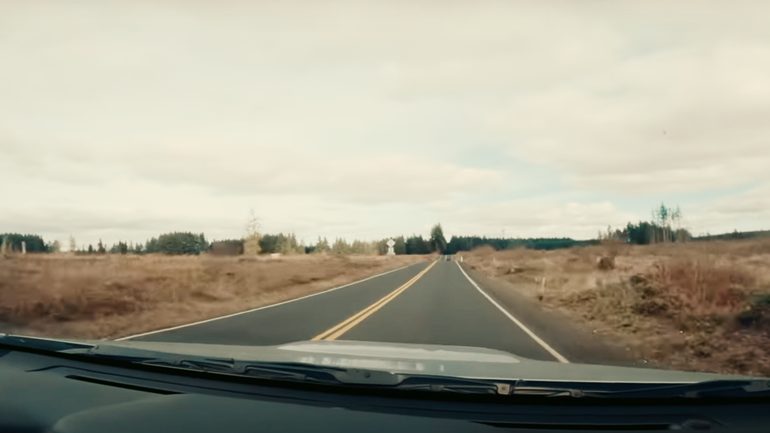
Military RD S - A western Cowlitz and Lewis County tour
April 2, 2023 LEWIS COUNTY, WA
On my way back from a recent visit to Portland, I took a couple of backroads first, just to the west of I-5 then crossing over at Chehalis to cut east then north.
For the most part, Westside Highway is pretty easygoing. Gentle curves and rolling hills. Though of course, I ended up behind a couple of drivers that had less of a sense of urgency than I did. A recurring thought I had: This would be great at about 4 in the morning or late at night.I did hit an unexpected gem in the form of Military Road S. It has some good curves and drops, if you get the chance I recommend it. After Military RD, I went a little West then north through towns like Winlock and Napavine, before heading NE towards Chehalis. There I crossed over I-5 then headed north up through Eastside Centralia then north up the SR 507 before heading NW from Yelm to Nisqually and getting back on I-5.
Mapping Software
InRoute
Gaigps
Google Maps
MUSIC&SOUND FX
Velvet Fog - Brandon Mueller (https://www.epidemicsound.com/track/U...)
Ski Trip to Mars - Magnofield (https://www.epidemicsound.com/track/u...)
Like Clockwork - Benjamin King (https://www.epidemicsound.com/track/u...)
Spaces - Phello (https://www.epidemicsound.com/track/l...)
Sumerian Paradise - Dew of light (https://www.epidemicsound.com/track/y...)
Thanks for watching!
-S

SE Green River Headworks RD
February 8, 2023 PALMER, WA
I was getting the itch to end my exploratory hiatus, so I ran down to Palmer to try driving SE Green River Headworks RD and take a small trip to Howard A Hansen Reservoir. The drive out to Palmer isn’t bad either but I was looking to escape the towns and get rural. Unfortunately, I didn’t zoom in enough to notice the gate of the water filtration plant. Denied! I still got a little bit of a drive, but not as much as I was hoping!
Mapping Software
InRoute
Gaigps
Google Maps
Music (via Epidemic Sound)
* Schumann 432-1 Root Chakra Breathing - 369 : https://www.epidemicsound.com/track/j...
* Zilch - Jobii: https://www.epidemicsound.com/track/Y...
* The Disco Frog - Rymdklang Soundtracks: https://www.epidemicsound.com/track/d...
Thanks for watching!
-s

Deep in the Douglas County Hinterlands
September 29th, 2022 Douglas County, WA
HEADS UP: this one is little longer than my recent uploads. I’m working on changing my “format” during the off season.
Way back in September I needed to get out and do a drive. I took a day off from work and headed North East into the smoke hazed hinterlands. I had read a great old article about places in eastern Washington for drivers, and bicyclists. I had found another old motorcycle enthusiast website that was a great resource that I used for inspiration. With my new mapping software, I crafted a route, using those as a reference.
Head East on I-90, take a left up towards Leavenworth then right on the 2 towards Wenatchee. Turn left at Wenatchee (after getting some donuts) then head up US HWY 97 A like I did, or more smartly head north on the 2 (and continue as it turns into the 97). Get on McNeil Canyon Rd then look out for the gravel Road E NW on your left, and begin your winding gravel journey. I know I’ve been complaining about gravel, and I have been trying to avoid it, but at least the gravel out here was not off-road gravel but old agriculture road gravel.
Out here you’ll find relatively well-groomed gravel roads that see regular traffic, 2 lane highways with few cars, and slight curves and undulating levels. You may also find a stretch or two of pavement that no one else is on. You're surrounded by a rolling landscape strewn with huge boulders called Haystack rocks. You're definitely in farm country. End your drive at Crown Vista Point and look at Grand Coulee Dam and the town of Grand Coulee.
The actual route GPX (I ran into some dead ends): https://drive.google.com/file/d/1U3gV... Hot tip: Use Google Earth and Google Maps Street View as much as possible!
Software:
Inroute
Gaigps
Music (via Epidemic Sound)
Immersione - VELDA : https://www.epidemicsound.com/track/l...
Infinite Sea - Erik Fernolm: https://www.epidemicsound.com/track/Z...
Admit Defeat - Out Linear: https://www.epidemicsound.com/track/R...
Tell Me Something New (Tigerblood Jewel Remix) (Instrumental): https://www.epidemicsound.com/track/2...
Ascending - Brendon Moeller: https://www.epidemicsound.com/track/F...
Rebecca - Gridded: https://www.epidemicsound.com/track/c...
Wisteria Blue - Anna Landstrom: https://www.epidemicsound.com/track/Q...
Black Tern - By Lotus: https://www.epidemicsound.com/track/c...
Undertow - Gridded: https://www.epidemicsound.com/track/C...
Thanks for watching!
-s
Half-Paved - A Drive out on Butte Creek & Smith Creek Roads
Oct 19, 2022 RAYMOND, WA
North of Raymond Washington, on Highway 101, there’s a road that heads North East and connects to N River Road just up from Brooklyn.
Heading north on 101 take a right and you’ll drive about 10 miles until you hit the gravel section. The unpaved part is fairly well groomed, but once again: GRAVEL! I can’t escape it.
You’ll see farms, rolling hills, lots of trees, and tree tunnels. Fairly sparse on traffic, nothing overly challenging driving-wise, but still enjoyable in the early evening. The total distance is about 15miles.
Route GPX: https://drive.google.com/file/d/1rPvo...
Music (via Epidemic Sound)
Haga - West & Zander: https://www.epidemicsound.com/track/q...
Last Odyssey - ELFL: https://www.epidemicsound.com/track/p...
Future Daze - Major Tweaks: https://www.epidemicsound.com/track/J...
Thanks for watching!
-s

Deep River Road
Oct 7, 2022 NASELLE
*Disclaimer: Sorry for the shaky camera. I only noticed this after viewing the footage for this day. I discovered too late that mounting on the hood is not the best place.
Northwest of Rosburg, WA, on SR 4, take a right on East Deep River RD. You’ll start on payment, hit some gravel, hit some pavement, and then more gravel. Lots of tree tunnels and a few creeks makes for a very quiet and secluded drive. East Deep River Rd connects to…wait for it…W Deep River Rd, then Salmon Creek Rd, take the right fork up to 4900 RD. Follow that and reconnect with Salmon Creek Rd, take the right on 5910 Rd and do the loop back to Salmon Creek and follow it back out to 4.
The gravel sections weren’t too bad, and the pavement parts had plenty of turns and elevation changes, all the while you’re surrounded by trees and green.
Route GPX: https://www.google.com/maps/d/edit?mi...
Music (via Epidemic Sound)
Undertow - Gridded: https://www.epidemicsound.com/track/C...
Super 1 - Cospe: https://www.epidemicsound.com/track/M...
Violet Sky (Instrumental Version) - Phello: https://www.epidemicsound.com/track/7...
Pink Pulsar - ELFL: https://www.epidemicsound.com/track/w...
Sweet Escape - Aiyo: https://www.epidemicsound.com/track/w...
Thanks for watching!
-S
Abernathy Creek RD and more
Sep 15, 2022 LONGVIEW, WA
Just off of HWY 4 (WA) about 12 Miles west of Longview Washington, I take a trip up Abernathy Creek Road and venture onto the Wisconsin Truck Trail. While I’m out on the trail…a realization starts to percolate and become clear…more on that in a couple of following roads. Abernathy Creek RD was a nice drive and a couple of the (paved) roads after the truck trail were pretty enjoyable, but towards the end of this route, I ran into my old friend: Road Closed. If you have a gravel-friendly vehicle like a motorcycle, ATV, truck, or any other off-road vehicle, then Wisconsin Truck Trail would be a good fit for you; get out there and drive!
As always my music is from Epidemic Sound:
The Fortunate - Silver Maple - https://www.epidemicsound.com/track/u...
Moments of Sundown - Sum Wave - https://www.epidemicsound.com/track/d...A New Sleep - Arden Forest - https://www.epidemicsound.com/track/l...
Your Natural Habitat - Ealot - https://www.epidemicsound.com/track/G...
Time To Go - Ealot - https://www.epidemicsound.com/track/U...
GPX - https://drive.google.com/file/d/1wmpT...
Thanks for watching!
-S

California State Route 3 - Part 2 (Longform)
Jul 25, 2022 TRINITY NATIONAL FOREST, CA
This the part 2 of my drive on CA-3. The craziest thing is that I was just 8 minutes / 5.1 miles shy of reaching the 299 and heading east into Redding. Wow, that was a long but great drive. Hot tip: eat good food, keep hydrated, and have some ginger chews on hand. There at the end, I can admit that I was feeling a bit like I needed to dry-heave. I will say that I would drive it again and take some of the other side roads that link up to other small towns in the hills. Looking at them on the map, very twisty.
Music from Epidemic Sound
Cold Midnight - Squild: https://www.epidemicsound.com/track/j...
Watcher - Brendon Moeller: https://www.epidemicsound.com/track/Q...
Little Auk- Lotus: https://www.epidemicsound.com/track/q...
2099 - Wave Saver: https://www.epidemicsound.com/track/0...
Night Drive - Barbatula: https://www.epidemicsound.com/track/z...

California State Route 3 - Part 1 (Long Form)
July 22, 2022-TRINITY NATIONAL FOREST
Heads up viewer: This is mostly a long-form video broken into 2 parts. If you like driving and watching driving POV, this is for you. I realize it's long.
I recently drove down to Redding, CA to help some friends. While the bulk of the trip was on I-5, I decided to take a back road, if a numbered State Highway can be considered a back road, and drive down CA-3 before hooking east back towards Redding. CA-3 is a long winding 2-lane highway through the Trinity Forest. Plenty of gorgeous forests, mountains, lakes, and rivers. Unlike Seattle: the road is well maintained and clear, as well as a great drive.
This is my first foray into doing multi-cam editing in Premiere, and aside from a few hiccups early on, I saw a great tutorial on how to do it especially with how GoPros recorded footage. It's more of a long-form video, so I broke it into 2 parts. Part 1 will start in Etna and Callahan, then end at about minute 38.
Map animation: GPX Animator - https://gpx-animator.app
Routing: InRoute - https://carobapps.com/products/inroute/
Multi-cam editing tutorial from Mitchell Losey's channel:
• They never tell y...
Music from Epidemic Sound
Wind In Your Sails - Margareta - https://www.epidemicsound.com/track/i...
Beach Memories - Sum Wave - https://www.epidemicsound.com/track/J...
The Sun Might Rise in the West - Jakob Ahlbom - https://www.epidemicsound.com/track/Y...
Natura - VELDA - https://www.epidemicsound.com/track/l...
Deeper Insight - Pulsed - https://www.epidemicsound.com/track/W...
Maverick - Ooy - https://www.epidemicsound.com/track/H...
Drifted - Ran the Man - https://www.epidemicsound.com/track/n...
Contours - Brendon Moeller - https://www.epidemicsound.com/track/O...
The Fairies (Young Community Remix) (Instrumental Version) - Ramin - https://www.epidemicsound.com/track/O...

If you’re thinking to yourself driving west through South Bend Washington, “can I take a gravelly shortcut to highway 101?” The answer is yes!
Part 4 - South Bend Palix Road
May 19, 2022 - SOUTH BEND, WA
If you’re thinking to yourself driving west through South Bend Washington, “can I take a gravelly shortcut to highway 101?” The answer is yes! This is a nice road to try. It’s very well-groomed without any giant potholes. It was a little damp when I was on it so you might experience a little over/understeer if it’s a wet time of year. Granted it may always be like that since it’s close to the coast. You’ll save about 10 miles and maybe 10 minutes.
Directions: As you drive into the main part of (Old?) South Bend heading West, turn left on Willappa Ave, then just head straight through to the End of Pavement and Gravel road signs. It’s a fairly smooth 2 lane gravel/dirt road in a classic western Washington PNW forest.
Google map location: https://goo.gl/maps/kD8yZPpHU3Vt6qQH7
Music from Epidemic Sound:
Fogrunner - Valante :https://www.epidemicsound.com/track/Y...
Imaginations - Sum Wave: https://www.epidemicsound.com/track/U...
Midnight Sunlight - Tape Machines: https://www.epidemicsound.com/track/j...

I hit the Elk Creek - Mill Creek backroad. Lots of gravel, trees, and turns.
Part 3 - Elk Creek Road & Mill Creek Road
May 19, 2022 - SOUTH BEND, WA
If you’re thinking to yourself driving west through South Bend Washington, “can I take a gravelly shortcut to highway 101?” The answer is yes! This is a nice road to try. It’s very well-groomed without any giant potholes. It was a little damp when I was on it so you might experience a little over/understeer if it’s a wet time of year. Granted it may always be like that since it’s close to the coast. You’ll save about 10 miles and maybe 10 minutes.
Directions: As you drive into the main part of (Old?) South Bend heading West, turn left on Willappa Ave, then just head straight through to the End of Pavement and Gravel road signs. It’s a fairly smooth 2 lane gravel/dirt road in a classic western Washington PNW forest.
Google map location: https://goo.gl/maps/kD8yZPpHU3Vt6qQH7
Music from Epidemic Sound:
Fogrunner - Valante :https://www.epidemicsound.com/track/Y...
Imaginations - Sum Wave: https://www.epidemicsound.com/track/U...
Midnight Sunlight - Tape Machines: https://www.epidemicsound.com/track/j...

Part 2 - Drive to Elk Creek RD
Mar 20, 2022 - CHEHALIS, WA
After driving to Ceres Hill RD, where the pavement ended, I take a break and check out the scenery. I discover the remains of possible Predator activity. Head out onto State Route 6, and check out Rainbow Falls, then continue on to the start of Elk Creek Rd.
Rainbow Falls State Park: https://tinyurl.com/5pc4z8dx
Music from Epidemic Sound: https://tinyurl.com/yuw2ctzj

Part 1 - Drive to Ceres Hill Rd
Feb 27, 2022 WASHINGTON
The first video in this project! From Seattle to Ceres Hill RD. From Rochester (WA) I take a mixture of small backroads: Michigan Hill Road SW, Lincoln Creek Rd, Ingalls Rd, Bunker Creek Rd, until I finally get to Ceres Hill Rd, and the pavement ends.
Plenty of great driving and scenery.