
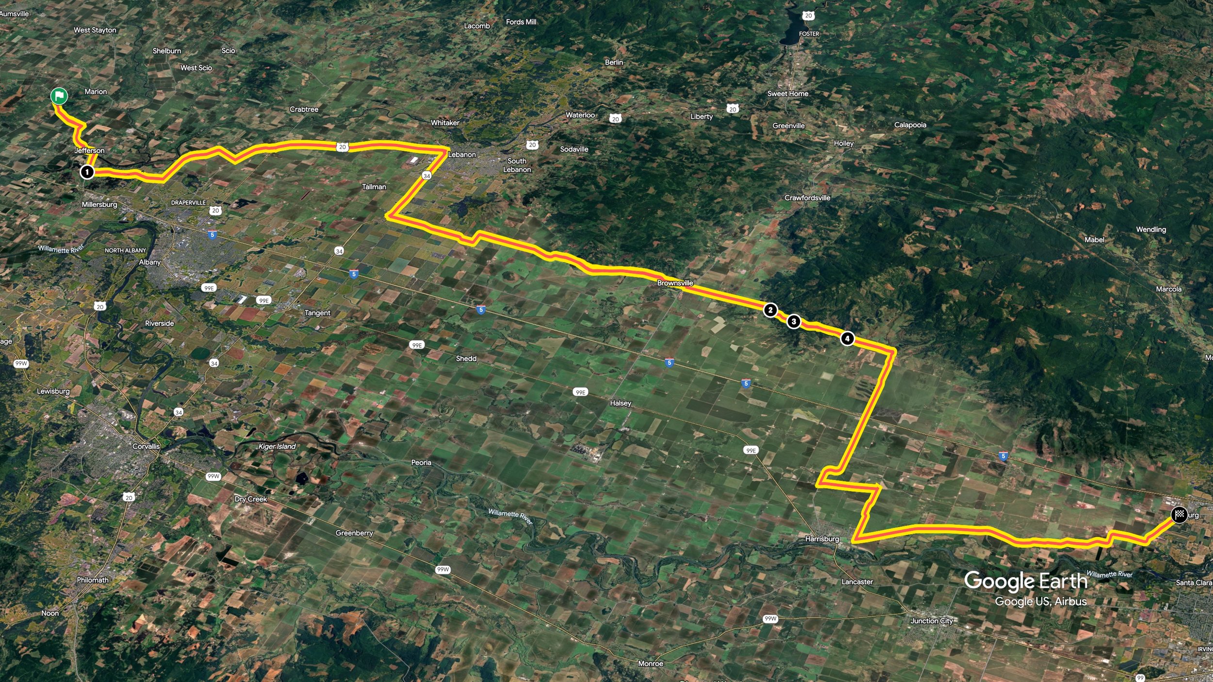
DRiVE1 / Route1
Salem to Coburg
Parrish GAP Rd SE
It’s February 24, and I’m on another road trip down to California. I’m meeting up with my friend Rich and joining him on his track day at Laguna Seca. Of course this provided an excellent opportunity to drive a couple of routes I had previously mapped. I planned out a path from Salem down to Veatch and beyond, but the weather was against me and forced me to cut it short in few places.
PART 1/4
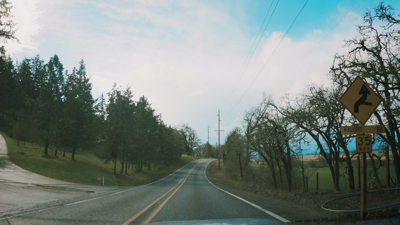
Here I’m on Parrish Gap Rd SE, which is kind of the first part of 4 sections that are on the East side of Intersate-5. I’ve cut out some of the connecting pieces as they were mostly more like state highways than backroads, and because of weather.
Parrish Gap Rd SE is curvy 2 lane path through a heavily agricultural-ranchy area. I was able to hook up the cameras once the rain took a break, so I caught the last part of it.
I also subjected myself to some routing woes as I didn’t put my map points accurately enough, which let me enjoy an extra 20 minutes of driving in a circle or just driving out and back to my start point. It was super “great.” Though I will say that Winter Creek RD SE’s long site lines and rolling elevation changes were pretty nice.Some nice curves and elevation changes, relatively well maintained, and not toooo busy, but lots of driveways and not long enough to really get into a groove. I likely won’t repeat it.
Up next in about 22mi are three roads starting with Steckley RD plus some fun map mishaps, where I head to and through Brownsville.
STECKLEy, Sand Ridge & Brownsville RDS
PART 2/4
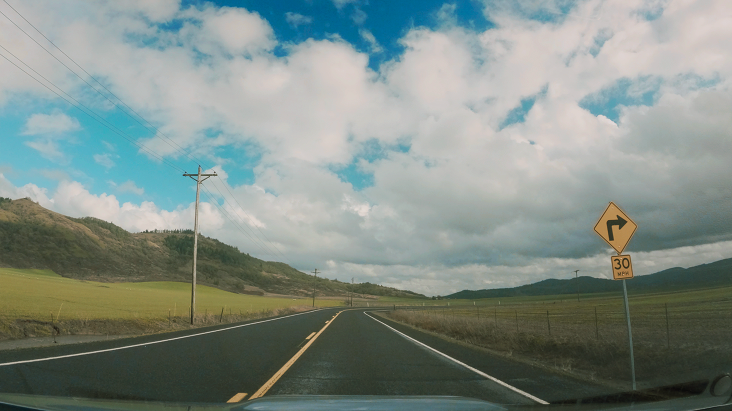
It’s 22mi since Parrish Gap RD SE and the weather has briefly cleared up with sunshine and a taste of bright blue skies! I’ve turned left/south off of Corvallis-Lebanon Hwy 210 or 34 and onto Steckley Rd.
This is really a smooth two-lane continuous line all the way into Brownsville, and on the map it’s broken into three separate roads: Steckly-Sand Ridge-Brownsville Rds. The road nestles against the hills of Peterson Butte on my left and then along Long Pine Butte with the farmlands of the Willamette Valley spread out off to my right. The day turned out gorgeous, well, at least for this part of it! Sand Ridge Rd is the flattest part of this three-part series, and once it connects to Brownsville Rd it starts to climb up a little…it’s hill adjacent.
Off in the distance, I could see that I was heading towards gray curtains of rain. As I approach Brownsville more and more houses are starting to appear and when I crest into the town, Brownsville Rd turns into Main St. Driving through Main Street (with that fun little left-right) my impression was of a classic old-school Americana western downtown. Brick and wood, a little bit of a classic movie feel. From there, it’s over the Calapooia River before going straight down to a quick right onto Bishop Way or Halsey-Sweet Home highway, then an immediate left onto Washburn Street which then becomes Gap Rd.
GAP RD
PART 3/4
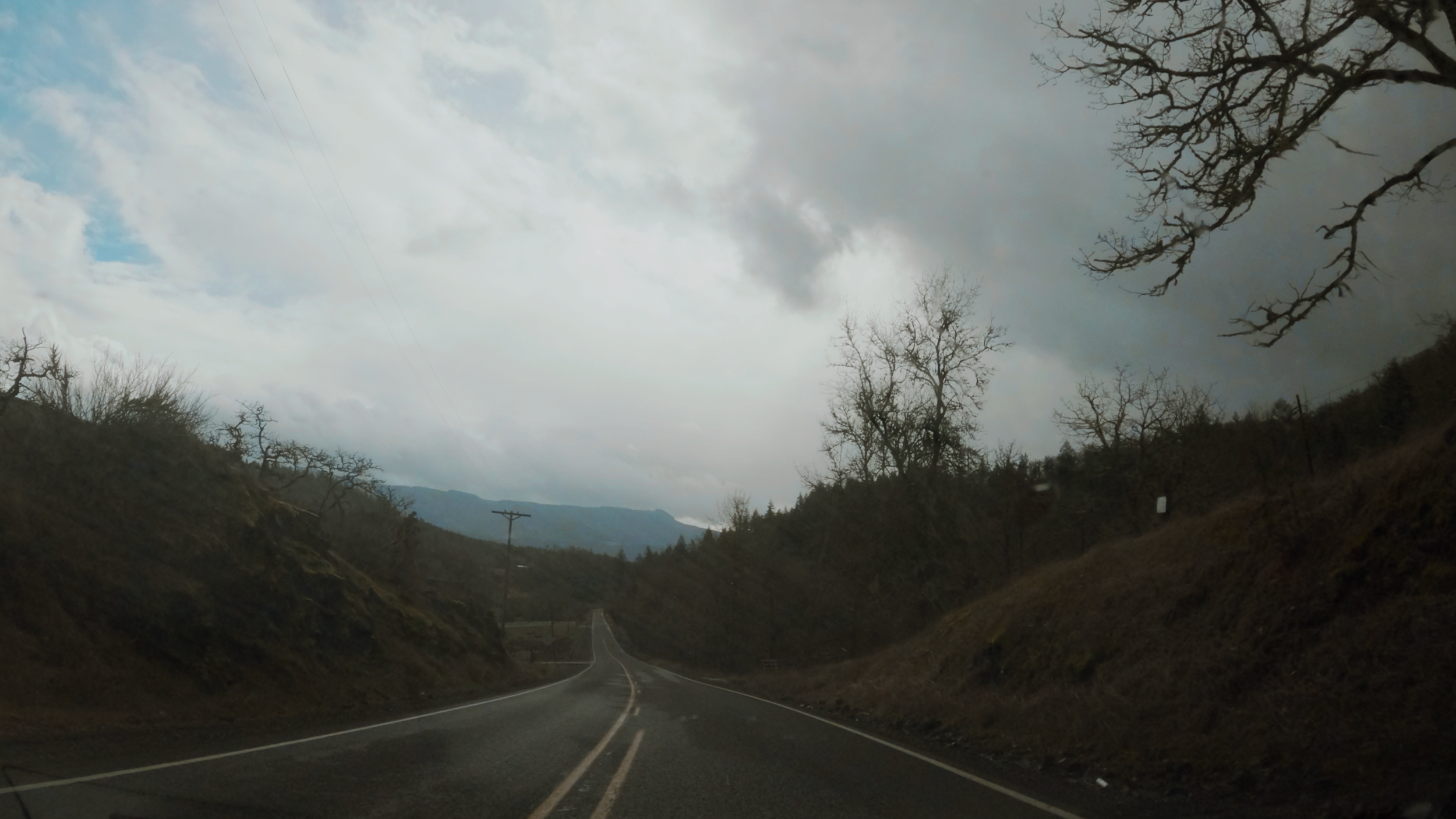
Leaving Brownsville and continuing south on Washburn St until it becomes Gap road I’m immediately hit with a downpour! So heavy! I’m not sure it’s viewable by the camera, but there was like a foot high white-gray zone of static on the road in front of me. When I was telling it to a friend, he knew exactly what I was talking about. He described that the rain is hitting the road so hard and so much that it’s atomizing water, creating that static effect.
After that water drama, it relaxed a bit and I carved and curved my way south up through the hills until revealing more Willamete valley farmland to west/right. This eventually straightened out with Gap Rd curving off to my left while I head directly west on diamond hill rd.
It was nice, I wish the weather had been clearer! But it was enjoyable carving up and through the hills a bit, and it had some gorgeous views.
A solid choice for an easy to get to break from the interstate. Next time, I need to continue on Gap Rd farther south before it crosses over i-5.

DIAMOND HILL RD
PART 4/4
Leaving Gap road I merge onto Diamond Hill road heading west back across i-5. Up next is a series of sections that go out then back down again to Coburg Oregon. Rain was off and on, and it was pretty uneventful. I’ll be showing the “highlights,” well what highlights there were!
One of those highlights…maybe the only one? : a giant road cleaning tractor keeping Diamond Hill east of i-5 pristine and smooth. Those farmers must pay some good taxes to have that guy out buffing out that road! Pretty impressive.
Crossing over I-5 it’s more flat roads and more of…wait for it…Willamette Valley farmland. Heading west on Diamond Hill I turn south on Powerline then West on Priceboro Dr before connecting with Coburg Road right outside Harrisburg and heading south. There were…cont.
…curves here and there, but the number of driveways and the rain prevented any truly spirited driving.
The transition from agriculture to the town of Coburg is pretty quick, and I pull into a nice little spot next to a park to take stock, and pull my cameras, then head back to the interstate to connect with my next Route.
I give Diamond Hill-Powerline-Hillsboro-Coburg Rds a 2-star - ok. Nothing really special, not a route I would repeat. Nothing really sticks out… a good description of the route would be flat.
CONCLUSION
Well that full path was a mix! The aggregate score came out to 2.5 Stars: Fair. Definitely, some great sections here and there, with a lot of uninteresting connectors. However, the views were great, and the rain was sometimes crazy. I was also able to finally experience what I had been seeing off in the distance the last few years of heading up and down I-5 in this part of Oregon. With better weather I’m hoping to go even a little deeper into those hills next time.